top of page
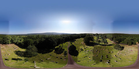
3 East 1_032221.JPG

Sunrise Aerial Imaging, LLC

SERVICES
Orthomosaic.png
Aerial Photography

Utilizing one of our many 4K equipped drones, we can provide top quality aerial photos and videos to meet any need.

Construction Imaging

Reduce the amount of time it takes to gather important data, increasing efficiency and decreasing overhead. Track materials to reduce shrinkage.

Pix4D photogrammetry, data and reporting available.

Infrastructure Inspection

Powerlines, towers, wind turbines, bridges, or any other structure that needs to be inspected. Images can be gathered and sent to you or live-streamed to an onsite HD screen to allow your staff to view images in real time.

Educational Consulting

Are you looking to add drone curriculum to your CTE or STEM classroom? With over 10 years of experience in CTE and emerging technology integration, we can help you develop an effective, safe and compliant drone program for your school or district.

Looking for additional services? 

About

02

WHY AERIAL IMAGING?

Give Your Clients and Key Stakeholders a Different Point of View

Sunrise Aerial Imaging integrates emerging technology with existing procedures to provide real-time data, images, and a different point of view to help companies make more timely and accurate decisions.

By utilizing drones, 360 videos, cutting-edge 3D imaging software, and other emerging technology as needed, Sunrise Aerial Imaging can reduce time, decrease costs and increase safety.

Sunrise Aerial Imaging can identify your challenges, recommend emerging technology integration and provide services to help you deliver the top quality product or service your clients expect.

Portfolio
bottom of page